Fiche technique
Poids : 400 g
ISBN : 978-3-8331-5771-4
EAN : 9783833157714
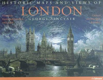
Historic maps and views of London
Quatrième de couverture
Cartes et vues historiques de Londres
Vingt-quatre cartes et vues historiques de Londres et de ses environs, du XVe siècle à nos jours, à encadrer en format standard
Cette superbe et fascinante collection comporte, entre autres, la plus ancienne miniature connue de Londres, une vue sur la Tamise pendant la frost fair de 1684, une carte qui montre la ville avant la destruction par le Grand Incendie en 1666, des vues de certains monuments, comme, par exemple, la Tour de Londres, Big Ben et Buckingham Palace, un plan des correspondances du métro londonien de la fin du XVIIIe siècle et un autre encore, version ludique actuelle. Les descriptions des tableaux fournissent des données sur l'impression ainsi que d'autres dates et faits historiques importants, tout comme des détails des cartes. Toutes les cartes jouissent d'une parfaite reproduction, de couleurs brillantes et de détails au contour net.
Historic maps and views of London
Twenty-four historic maps and views of London and its environs - dating from the 1500s through the present - ready for framing in a standard frame
This beautiful and fascinating collection contains the earliest known painting of London, a view of the Thames during the Frost Fair in 1684, a map depicting the area destroyed by the Great Fire in 1666, views of such landmarks as The Tower of London, Big Ben, and Buckingham Palace, an early map of the London Underground dating from the late 1800s, and a playful version of today's iconic Tube map. Each map's original printing information is provided, as well as additional information that places it in historic context and further illuminates its qualities. Each map is exquisitely reproduced to show off its color and detail.
Historische karten und ansichten von London
Vierundzwanzig historische Karten und Ansichten von London und Umgebung - vom 15. Jahrhundert bis heute - zum Einrahmen in handelsüblichen Bilderrahmen
Diese wunderschöne und faszinierende Sammlung enthält unter anderem das älteste bekannte Gemälde von London, ein Blick auf die Themse während des Frostjahrmarkts 1684, eine Karte, die die Stadt vor der Zerstörung durch den Großen Brand 1666 zeigt, Ansichten einiger Sehenswürdigkeiten, wie zum Beispiel den Tower von London, Big Ben und den Buckingham Palace, eine Streckenkarte der Londoner U-Bahn aus dem späten 18. Jahrhundert und eine verspielte Version der U-Bahn-Streckenkarte aus der Gegenwart. Die Bildbeschreibungen liefern Angaben zum Druck sowie weitere historisch wichtige Daten und Fakten sowie ausführliche Erläuterungen zu den Karten. Alle Karten in vorzüglicher drucktechnischer Wiedergabe, brillanten Farben und Details.


