Fiche technique
Format : Broché
Nb de pages : 54 pages
Poids : 834 g
Dimensions : 29cm X 36cm
ISBN : 978-3-8331-5772-1
EAN : 9783833157721
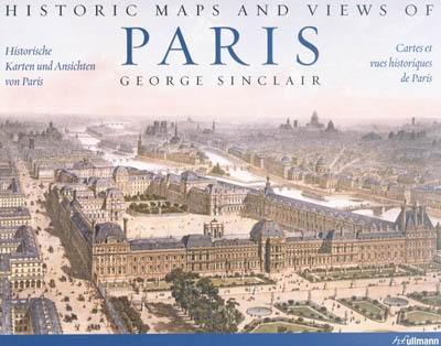
Historic maps and views of Paris
Quatrième de couverture
Cartes et vues historiques de Paris
Vingt-quatre cartes et vues historiques de Paris et de ses environs, du XIIe siècle à nos jours, à encadrer en format standard
Cette fascinante et superbe collection comporte une vue de Versailles datant de 1668, un plan détaillé de l'île de la Cité, un plan de métro de 1920, des vues d'oiseau de Paris et de la tour Eiffel pendant l'Exposition universelle de 1889, d'imposantes vues des emblèmes parisiens (parmi lesquels le Louvre, l'Arc de Triomphe, Notre-Dame et le Sacré-Coeur), et bien d'autres encore. Les descriptions des tableaux fournissent des données sur l'impression ainsi que d'autres dates et faits historiques importants, tout comme des détails des cartes. Toutes les cartes jouissent d'une parfaite reproduction, de couleurs brillantes et de détails au contour net.
Historic maps and views of Paris
Twenty-four historic maps and views of Paris and its environs - dating from the twelfth century through the present - ready for framing in a standard frame
This beautiful and fascinating collection contains a view of Versailles from 1668, a detailed plan of île de la Cité, a bird's-eye view of Paris and the Eiffel Tower during the 1889 World's Fair, a map of the Metropolitan Railway and Underground from 1920, stunning views of Paris sites and landmarks (including the Louvre, the Arc de Triomphe, Notre-Dame, Sacré-Coeur), and much more. Each map's original printing history is provided, as well as additional information that places it in historic context and further illuminates its qualities. Each map is exquisitely reproduced to show off its color and detail.
Historische karten und ansichten von Paris
Vierundzwanzig historische Karten und Ansichten von Paris und Umgebung - vom 12. Jahrhundert bis heute - zum Finrahmen in handelsüblichen Bilderrahmen
Diese faszinierende und wunderschöne Sammlung enthält eine Ansicht von Versailles aus dem Jahr 1668, einen detaillierten Plan der île de la Cité, einen Métro-Plan von 1920, Paris mit dem Eiffelturm während der Weltausstellung von 1889 aus der Vogelperspektive, beeindruckende Ansichten von Pariser Wahrzeichen (darunter der Louvre, der Arc de Triomphe sowie Notre-Dame und Sacré-Coeur) und viele weitere mehr. Die Bildbeschreibungen liefern Angaben zum Druck sowie weitere historisch wichtige Daten und Fakten sowie ausführliche Erläuterungen zu den Karten. Alle Karten in vorzüglicher drucktechnischer Wiedergabe, brillanten Farben und Details.


