Fiche technique
Format : Etui
Poids : 104 g
Dimensions : 19cm X 34cm
ISBN : 978-2-38036-103-2
EAN : 9782380361032
Quatrième de couverture
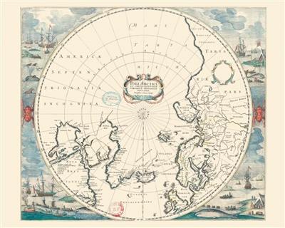
Cette carte hollandaise du pôle nord et de ses alentours doit beaucoup à deux grands explorateurs du tournant du XVIIe siècle : à l'est, le hollandais Willem Barentsz (1550-1597), qui a cherché en vain le passage du nord-est ; à l'ouest, l'anglais William Baffin (1584-1622), qui a cherché en vain le passage du nord-ouest. La cartographie de ce temps, particulièrement à ces latitudes, n'en reste pas moins approximative et pleine de zones doublement blanches. L'auteur, cartographe du « siècle d'or » à la Haye, les entoure de belles images évocatives mais ne cherche pas à les dissimuler.
This Dutch map of the North Pole and its surroundings owes a great deal to two major explorers at the turn of the 17th century : to the east, the Dutchman Willem Barentsz (1550-1597), who searched in vain for the North-East Passage ; to the west, the Englishman William Baffin (1584-1622), who unsuccessfully searched for the North-West Passage. The cartography of this time, particularly at these latitudes, remained nonetheless approximate and is filled with double-blank areas. The author, a cartographer of the « golden century » in the Hague, has surrounded them with highly evocative images but has not tried to conceal them.


